
Sterling ZIP Coverage
County records identify three ZIP codes serving Sterling: 20164, 20165, and 20166. They are postal geography, not town boundaries. Loudoun’s ZIP metadata says the boundaries come from USPS, are stored as GIS areas, and are maintained as needed. The table uses the county’s documented labels and area descriptions. An exact address remains necessary for a mailing decision because a community name, a county record, and the postal city can use different labels.
| ZIP | Areas Covered | Post Office | Notes |
|---|---|---|---|
| 20164 | Central and older Sterling Park area, plus surrounding Sterling addresses. | Sterling postal area | County ZIP metadata labels it STERLING; the boundary is USPS-derived rather than a CDP boundary. |
| 20165 | Sterling addresses and the Potomac Falls, Cascades, and Countryside community labels commonly associated with this postal area. | Sterling address label | Verify the exact address with USPS because postal-city and community labels can differ. |
| 20166 | Sterling and Dulles area, including airport, Route 28, industrial, and newer eastern or southern areas. | Sterling in county metadata | The county population report labels this ZIP Dulles, while county ZIP metadata labels it STERLING. |
The county’s historic ZIP population table listed 2010 boundary-era estimates of 35,737 for 20164, 31,046 for 20165, and 7,555 for 20166. Those are not current Sterling population totals and should not be used to draw a municipal line. They describe the ZIP geography used in that historical table, with 20166 labeled Dulles. The ZIP code directory therefore works as a postal and parcel filter, not as a census of a city.
Sterling ZIP Labels
Postal naming has a local wrinkle. Both 20164 and 20165 are county-labeled Sterling ZIPs. For 20166, the county ZIP metadata uses STERLING while the county population material uses Dulles. That difference does not signal a bad address. It shows that postal labels, historical reports, and the Sterling census-designated-place line were created for different purposes.
A 20165 address can be identified with Potomac Falls, Cascades, or Countryside in one source while a county property record uses Sterling. A 20166 address can be near Dulles or Route 28 while its county ZIP metadata is Sterling. Record searches should begin from an exact street address and unit, then retain the ZIP as one search field. A ZIP label alone should not be treated as proof of a person’s current residence or a property’s local identity.
20166 Sterling ZIP Geography
The 20166 label is the clearest example of Sterling’s overlapping geography. County ZIP metadata labels 20166 STERLING, but the county’s historic population report calls it Dulles. The documented area includes the airport and Route 28 area as well as industrial and newer eastern or southern areas. Neither label overrides the other record systems. USPS address verification resolves the mailing answer for a specific delivery address.
This mismatch is also why a ZIP cannot stand in for a county election district or the CDP boundary. WebLogis has layers for ZIP Codes, parcel boundaries, address points, subdivisions, election districts, schools, zoning, planning, and environmental features. Turning on one layer does not change the boundary drawn by another. Keep the layer name with any map note.
Sterling Parcel ZIP Filters
The Loudoun real-property screen is the ZIP-capable county record route. It returns property records matching a ZIP rather than a roster of residents. Use it to find parcels, then inspect the owner, situs address, legal description, sales data, and PIN associated with a result. A parcel mailing address can be elsewhere, and an owner entry does not establish who currently occupies the address.
Open the Loudoun real-property search to use the documented ZIP field.
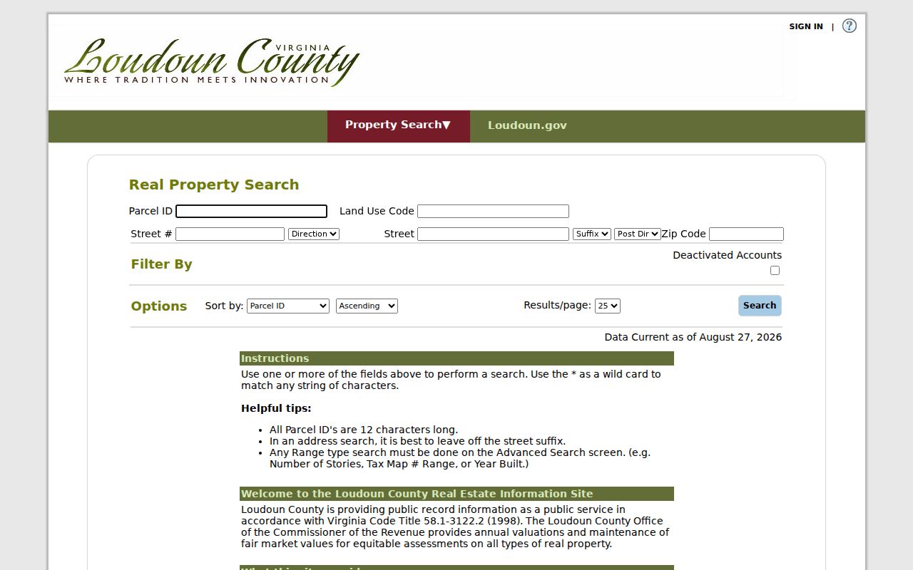
The screen places the ZIP field alongside parcel and street controls, which makes it useful for narrowing a property search before checking a particular address. The county describes the database as updated weekly.
| Field label | Type | Required | Options or format |
|---|---|---|---|
| Parcel ID | Text | Not stated | PINs are 12 characters. |
| Land Use Code | Text or selector | Not stated | Available in Real Property mode. |
| Street # | Text | Not stated | May be combined with Street or the ZIP field. |
| Street | Text | Not stated | Wildcards are accepted; street and suffix selectors are available. |
| ZIP Code | Text | Not stated | Returns matching property records. |
| Street/suffix selectors | Selector | Not stated | Available with the street fields in Real Property mode. |
| Advanced Search | Search mode | Not stated | Holds range criteria such as stories, Tax Map range, or year built; the full public dropdown list was not captured. |
Sterling ZIP Boundaries in WebLogis
Loudoun WebLogis supplies the county map view for a property result. Search by address or PIN, then turn on the ZIP Codes layer with parcel boundaries and address points. The map supports parcel and adjoiner tools, but its ZIP display is best read as a layer that helps test where a parcel lies against the county’s USPS-sourced metadata.
WebLogis can also show subdivisions, roads, election districts, schools, planning, environmental, utility, and zoning layers. Those layers help explain why the same Sterling postal label may not match another jurisdictional line. The residential-permit GIS layer is a separate county layer with ZIP and ZIP Area fields, plus address, PIN, month and year issued, unit type, subdivision or project, census block, and election district.
Note: County ZIP metadata is maintained as needed, so use the USPS result for the mailing ZIP rather than assuming a map layer is a delivery-address confirmation.
Find Residents by Sterling ZIP
A ZIP-wide query should be framed as a property and geography workflow. The assessor accepts a ZIP filter. WebLogis shows the ZIP boundary and parcel joins. The county permit GIS layer includes ZIP fields. Voter and court systems are oriented to an individual, locality, district, name, or case and do not provide a public ZIP-wide resident export. The official voter pathway is limited to a person’s own status or the legally available inspection form.
- Begin with the full street address and unit. Use USPS to check the ZIP and acceptable postal label before putting a ZIP into a county record search.
- Enter the verified ZIP in Loudoun’s Real Property mode. Review the matching parcel rows and save the PIN, property address, legal description, and record date for the address that matters.
- Open the address or PIN in WebLogis. Switch on ZIP Codes, parcel boundaries, and address points to see the parcel in relation to the postal layer.
- Use the selected address, not the whole ZIP, for a more focused record trail. A street-level chain of property, GIS, and deeds is available through the Sterling street directory.
- Where a voter question is relevant, use the Citizen Portal only for the individual’s authorized self-service status or ask Loudoun Elections about statutory public inspection. Do not expect a ZIP download.
The USPS ZIP Code Lookup is the verification route for a specific mailing address.
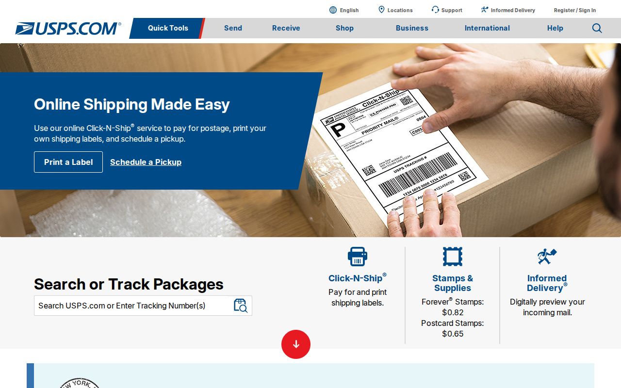
The USPS lookup provides the needed address-level check before a county ZIP filter is used. It does not replace the assessor, map, deed, or elections custodians for their separate records.
Sterling ZIP Permit Joins
ZIP and ZIP Area appear in the county’s residential-permit GIS layer. That layer describes issued residential permits beginning in 2010 and carries the permit number, PIN, street address, month and year issued, unit type, subdivision or project, census block, election district, and ZIP fields. It can help place a record in an area, but it is not a people list and it does not show everyone associated with an address.
For current permit status or a defined property question, Loudoun Building & Development uses LandMARC and a permit-inquiry route. The inquiry form calls for a property address, permit number when applicable, application date, and a summary of the issue or inquiry. The county says one property address and one permit number should be entered on the form, with a stated response expectation of two business days.
Sterling ZIP Boundary Limits
Sterling is an unincorporated census-designated place, not an incorporated city with a single city-limit boundary. ZIP boundaries, the CDP outline, postal-city labels, county election precincts, and subdivision names do not coincide. A map search must therefore identify which boundary is being asked about. For property records, the parcel’s situs address and PIN are stronger keys than a postal name. For mail, the full address and USPS result control the ZIP check.
Address terms are also distinct. A deed may use a lot, block, subdivision section, metes-and-bounds tract, or plat instead of a current street number. An assessor mailing address is where tax correspondence goes, while a situs address identifies where the parcel is located. A voter record can allow a P.O. box in defined circumstances, and court papers may have redacted service or party addresses. None automatically proves a current home address.
- ZIP vs ZIP+4
- A ZIP is the five-digit postal area. ZIP+4 adds four digits to help sort mail more precisely within that area.
- PO-box ZIP
- A ZIP used for post-office boxes. It can differ from the ZIP assigned to a physical delivery address.
- Unique ZIP
- A ZIP assigned for one organization or delivery purpose. It should not be assumed for a local address without a USPS confirmation.
- Carrier route
- A mail-delivery grouping used for sorting and delivery operations. It is not a public resident roster or a municipal boundary.