
Sterling Neighbors: Block Record Sources
A Sterling block can be read through several public sources, but they answer different questions. The map is best for the shape of the block and nearby parcel identification numbers. The assessment roll is best for recorded ownership and parcel facts. A deed or plat can explain a shared lot, subdivision, or easement. Community resources describe a development’s civic context, not a roster. Treat owner names and map points as record evidence, not as a complete account of who occupies a home.
| Source | What It Shows About a Block | Access |
|---|---|---|
| Loudoun WebLogis | Adjacent parcel geometry, PIN, address point, subdivision, roads, and selectable layers | Free public map with adjoiner and distance tools |
| Property assessment roll | Owner, property address, mailing address, unit, PIN, tax map, and last sale | Free county search, with weekly update notice |
| Deed and plat index | Prior owners, subdivision lots, easements, plats, and legal descriptions | Clerk terminals and remote copy route; charges can apply |
| Public voter-list inspection | Only the statutory fields for registered voters, subject to exclusions | Loudoun Elections office under Virginia law |
| County community map | Named developments, covenant, and association context | Free county page; member rosters are generally private |
| Library reverse directory | Historical address-to-subscriber clues if a documented volume exists | Verify a volume through Thomas Balch, LCPL, or FamilySearch |
Ownership and occupancy differ. An owner can receive tax mail somewhere else, and a parcel can be held by a trust, company, or association. Renters, nonregistered adults, utility customers, delivery recipients, and unlisted household members do not become public block entries merely because an address appears on the map.
Sterling Neighbors in Loudoun WebLogis
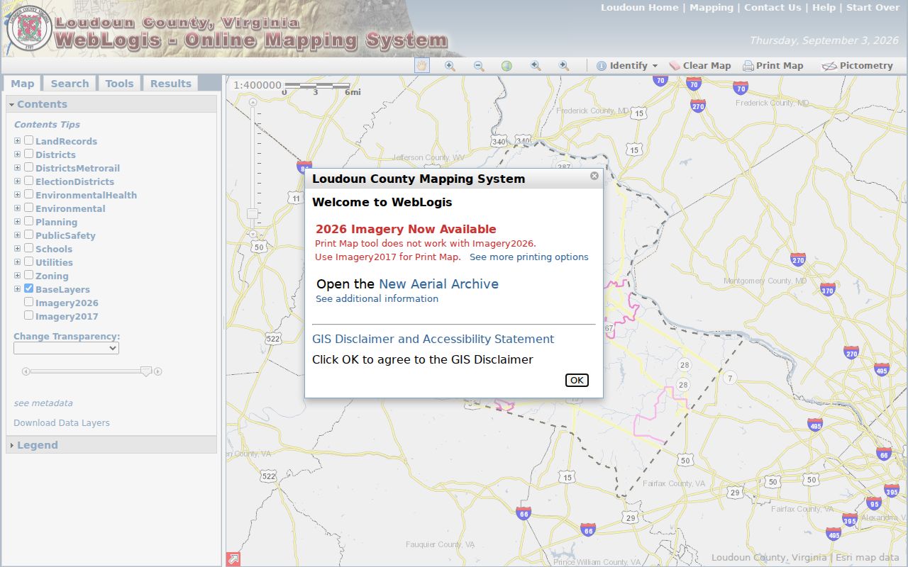
Loudoun WebLogis is the official starting tool for an immediate Sterling block. It accepts a street address through autocomplete or a PIN or map tile. The map can show parcel boundaries and labels, address points, subdivisions, road centerlines, ZIP codes, election districts, schools, planning, environmental, utility, and zoning layers. That mix is helpful for placing one parcel in its physical and civic setting, but none of the layers is a resident roster.
The WebLogis parcel and adjoiner screen shows the address and PIN entry routes used for a Sterling neighbor lookup.
Use the address that the county map recognizes, then retain the PIN with each map note. A unit, detached garage, or assigned parking space can have its own parcel identification number, so one street address does not always equal one parcel.
Map Sterling Neighbors Parcel by Parcel
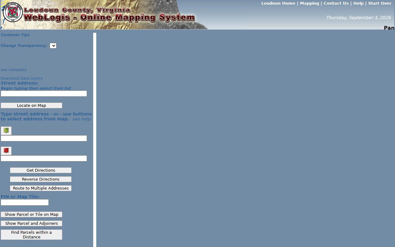
The county’s address-to-adjoiners method is a short, repeatable sequence. Type the address in WebLogis, select the autocomplete match, and choose Locate on Map. Use Show Parcel and Adjoiners, or click the parcel and choose Find Adjoining Parcels, to identify parcels that touch it. For a broader section of the block, select Find Parcels within a Distance and inspect the parcels inside the chosen radius. Each neighboring parcel can then be identified by its PIN and checked in the county assessor search.
- Enter the Sterling address in WebLogis, select its autocomplete match, and use Locate on Map.
- Choose Show Parcel and Adjoiners, or click the target parcel and use Find Adjoining Parcels, to list the touching lots.
- For a larger area, use Find Parcels within a Distance and inspect each result within the selected radius rather than assuming all are immediate neighbors.
- Carry each neighboring PIN into the Loudoun real-property search to read the owner, property address, mailing address, legal description, and sales context.
- Keep the map result and assessment result separate. A PIN ties the two systems together, but neither alone proves who currently lives at that location.
The WebLogis neighbor map instance illustrates the parcel layer and related map controls used in that process.
Once a PIN is in the assessor, compare situs and mailing address, legal description, last-sale record, and any unit designation. For a full named-street chain rather than a tight radius, use the Sterling street directory records path.
Sterling Neighbors Beyond a Parcel
WebLogis can add context that an assessment profile does not show. Parcel boundaries, address points, road centerlines, subdivision labels, ZIP codes, and election districts help distinguish a block that carries a Sterling postal label from one that crosses a planning or service boundary. The map can also expose zoning, environmental, school, water, and utility layers. Those layers explain the setting of a parcel, not the identities of people nearby.
A legal description and plat reference are especially useful when a street bends, lots are irregular, or a subdivision uses lot and block numbers. A plat is a recorded map of a subdivision or parcel layout. The deed and plat index can connect a boundary line or common tract to an instrument number, while the assessment roll supplies the current parcel identifier. Do not substitute a visual map edge for a recorded legal boundary.
County permit information can show block-level change evidence, such as a permit number, PIN, address, month or year issued, and project or unit data. Loudoun’s historical residential permit GIS layer begins in 2010. It is not a current household list, and the county’s LandMARC or permit-inquiry route is the proper follow-up for a defined permit record.
Sterling Neighborhood Association Context
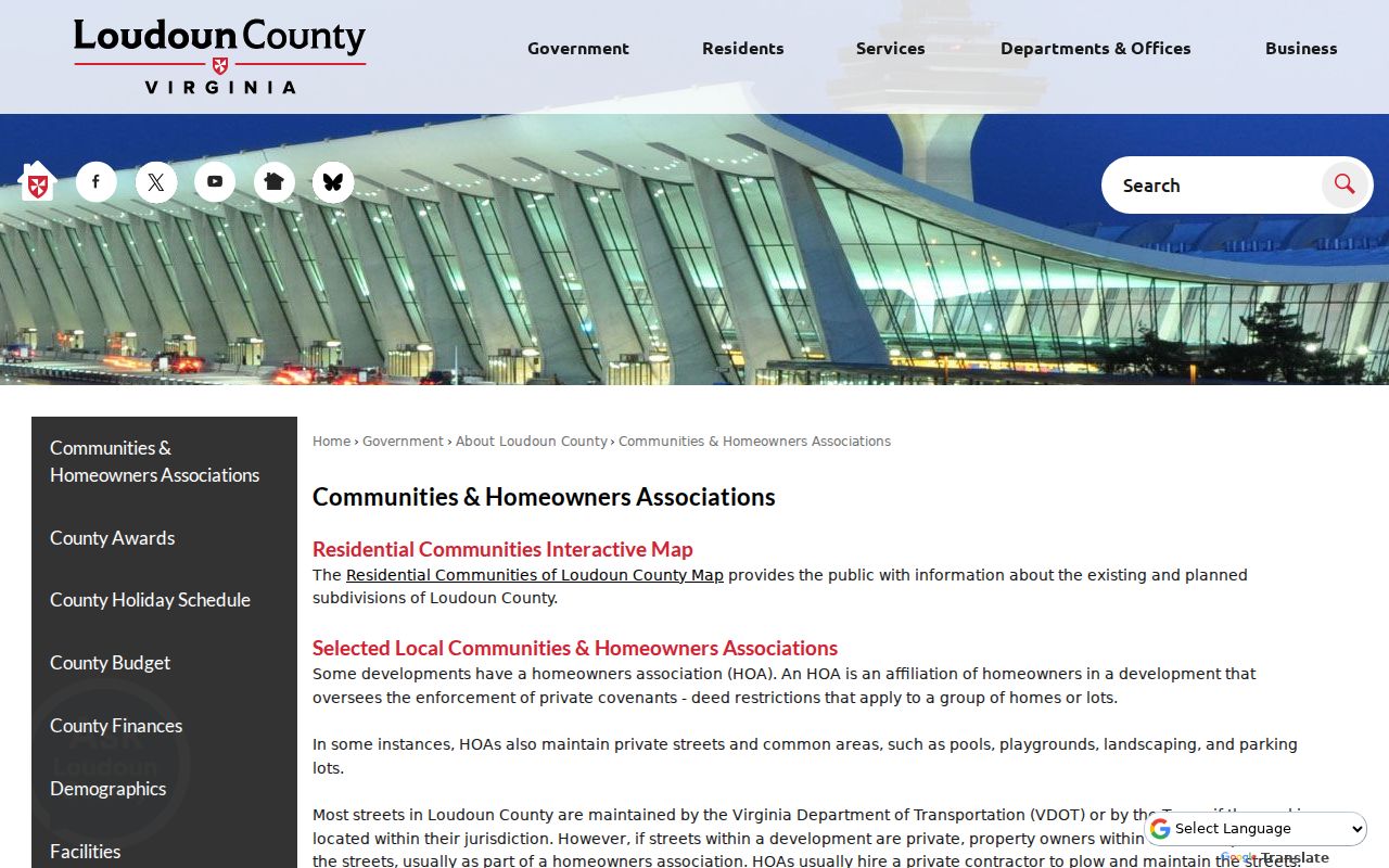
A community name is useful for interpreting a block, but it does not create a public directory of Sterling neighbors. The Loudoun County communities and homeowners associations page maps selected residential communities and explains the county’s association context. It can help distinguish Sterling, Cascades, Countryside, Potomac Falls, Sugarland Run, Seneca Ridge, Rivercrest, and other development labels that appear in nearby records.
| Community reference | What the county material supports |
|---|---|
| Sterling Park | A 2009 county community report says there is no single HOA for Sterling Park. |
| Sterling Foundation | County planning material identifies it as a nonprofit civic layer, not a block-member roster. |
| County community map | Shows development and association context; recorded covenants remain the authoritative property record. |
| Association contacts | Public contact pages may be available, while membership and resident rosters should not be assumed public. |
The county community-association map is a useful source for Sterling neighborhood context.
Virginia DPOR licensing and regulation of associations, and a covenant filed in land records, do not turn private member lists into public records. Ask an association only for its public-facing contact route or a recorded covenant reference when that is the legitimate need.
Sterling Neighbors and Neighborhood Names
Neighbor records also reflect Sterling’s changing local geography. Guilford Station was the earlier railroad and post-office name, and the station became Sterling in 1887. Older deed, newspaper, cemetery, and directory searches may therefore use Guilford, Sterling, Leesburg, or a county place name rather than the same neighborhood label seen on a modern parcel map. A historical name is a search key, not proof that an older entry belongs to a present-day block.
Sterling Park added the modern subdivision layer after its 1961 planned-community approval, while later developments such as Sugarland Run, Cascades, Countryside, and Seneca Ridge created distinct subdivision records. A parcel’s legal description and subdivision label are safer connectors than a broad community name. The county’s ZIP metadata adds another limit: postal, CDP, and election boundaries do not necessarily coincide, so use the exact address and WebLogis layer before assigning a block to a named neighborhood.
Sterling Neighbors and Voter Lists
Virginia’s voter law permits public inspection of a defined list, not a universal block roster. Under Va. Code § 24.2-444, the public list has a voter’s name, residence address, year of birth, gender, and applicable election districts. It does not include a Social Security number, day or month of birth, registration-agency identity, or certain protected residence addresses. Virginia does not use party registration in the ordinary record.
For a legally available inspection, the Loudoun Elections and Voter Registration Office is the county route. The state Citizen Portal is a person’s own registration-status, polling-place, ballot-status, and voting-history path. It is not a tool for inferring all adults at a nearby address. A renter may appear only if registered there, and a nonvoter will not appear at all.
Va. Code § 24.2-405 limits distribution of full voter lists to stated recipients and purposes, and bars searchable Internet republication. ACP participants and permitted P.O. box exceptions further reduce public visibility. Respect those gaps rather than treating them as search problems to bypass.
Sterling Neighbors: Official Source Comparison
Official block records are narrow but traceable. WebLogis identifies adjacent land and the assessment roll identifies recorded parcel owners. Deeds and plats can explain a legal relationship among lots. Commercial neighbor-category tools may combine public records, marketing data, self-reported entries, and other purchased information. They can mix same-name people, retain a former address, or imply a relationship that an official record does not support.
| Record path | Best use | Boundary |
|---|---|---|
| WebLogis plus assessor | Identify parcels around an address and their recorded owners | Does not establish all current occupants |
| Deed or plat record | Confirm a legal description, prior transfer, or subdivision reference | May require a copy, terminal, or Clerk request |
| Commercial category tool | Surface unverified leads for later confirmation | Not an authority for a current block or protected data |
The strongest neighbor lookup records the address, PIN, source, and access date, then confirms a material fact with the proper custodian. Never treat a compiled profile as more reliable than a dated county instrument or an official portal result.
Note: A property owner’s mailing address, a voter-list field, and a map point can describe different aspects of the same parcel without identifying every resident there.
Sterling Neighbor Lookup Privacy Limits
Important portions of a block remain private. Utility customers, delivery information, DMV addresses, unregistered residents, nonpublic association rosters, and most details about renters are not an official neighbor index. Public records can also contain mailing addresses that differ from the place shown on the parcel map. That difference may reflect correspondence, a trust, an agent, or another lawful purpose, not a person’s current location.
Virginia’s Address Confidentiality Program statute protects qualifying participants through a substitute address and mail-forwarding system. Its actual address records are FOIA-exempt. Sealed court records and other victim protections can also restrict disclosure. Virginia’s anti-stalking law, Va. Code § 18.2-60.3, is another boundary against repeated monitoring or unwanted contact. A county office may explain its request process, but it cannot provide a protected address or build a custom list from nonpublic data.